


Prehistoric Sistine Chapels: The Ancient Rock Art Caves of Gilf Kebir
The Edge of the Known World: Exploring Egypt's Gilf Kebir Plateau
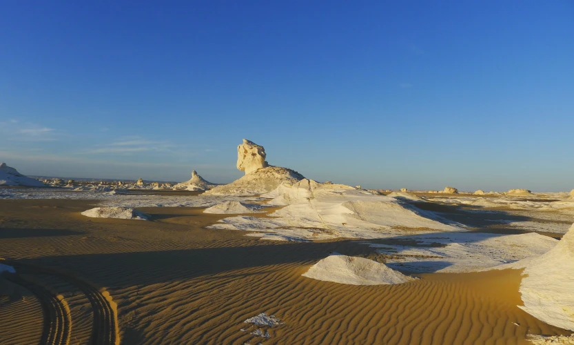
In the very furthest, kind of isolated corner of southwest Egypt there’s a place where the geography doesn’t feel like landscape so much as it feels like an imposing kind of fortress. It rises, abruptly from the flat shifting dunes of the Great Sand Sea, as this colossal, table like mound of red sandstone that just sits there.
This is the Gilf Kebir (Arabic for “The Great Barrier” ) .
About the same size as Puerto Rico, this huge plateau is one of the most hyper arid and geographically cut off areas on our planet. It’s a land of sheer black and red cliffs, deep labyrinthine canyons, and quiet valleys that have stayed about the same for millennia. There are no roads , no cell signals , no permanent water sources . And no signs of modern human life for hundreds and hundreds of miles.
Still, under that harsh sun baked shell, there’s this geological and cultural treasure, like a hidden chest. The Gilf Kebir is basically a time capsule, preserving an energetic chapter of Earth’s past when the Sahara was a green savanna, full of fauna and also home to some of humanity’s first known artists.
1. The Great Barrier: Geography of an Ancient Fortress
The Gilf Kebir is this enormous geological thing, more like a giant, and honestly it kind of towers. It rises to over $1,000\text{ meters}$ ($3,300\text{ feet}$) above sea level, and it’s basically a tough sandstone mass that got split into northern and southern halves by those massive, sand choked openings.
Over millions of years, the fierce desert winds, plus the occasional cataclysmic floods, have worn away the edges. They formed deep, straight sided canyons, the wadis, and these cut into the plateau’s boundary zones. They also end up being the only entrance points, into the inner structure, kind of a narrow way in.
The best known one is Wadi Sura, which is also called the “Valley of Pictures,” and it works like a gateway toward the region’s prehistoric rock art. Another notable place is Wadi Hamra, and that one is known for its vivid deep red sand dunes, they spill over the plateau’s dark rock walls like frozen rivers of rust , creating this really strong visual contrast across the Sahara.
2. A Prehistoric Sistine Chapel: The Caves of Gilf Kebir
The real sort of magic of the Gilf Kebir is sort of hidden in those shallow rock shelters, you know. During the African Humid Period—around 10,000 to 5,000 years ago—this plateau that today feels mostly dry was actually a greener place, a well-watered highland. Neolithic people moved into the valleys, and they wrote down their daily life, their beliefs, and even the local setting straight onto the sandstone walls, pretty directly.
Now, yeah, the Cave of the Swimmers (the one people learned about from the movie The English Patient) gets most of the attention, but the bigger highlight, the crowning jewel, of prehistoric Saharan art is closer by at the Cave of Beasts, sometimes called the Foggini-Mestekawi Cave.
Found in 2002, this Cave of Beasts is among the most well-preserved, extensive, and complicated prehistoric rock art locations anywhere. The rock face is covered with thousands of paintings that look almost too detailed:
The Beast Figures, headless and many-legged creatures that seem to swallow human shapes, or else guard them, depending on how you read it.
Stencil Handprints, hundreds of negative prints made by blowing pigment, over a hand placed on the stone.
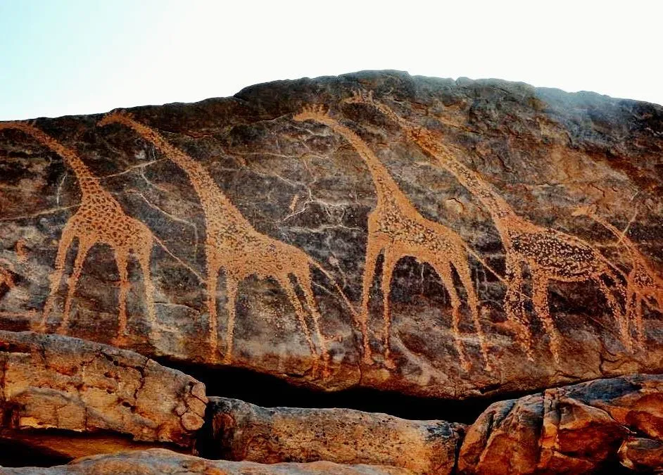
Fauna of a Green Sahara, sharp, high-contrast scenes of giraffes, ostriches, and domesticated cattle—like evidence that what is now a harsh desert was once open grassland.
And honestly these aren’t just casual marks or little scratches, they’re intricate spiritual maps of a disappeared culture’s way of seeing the world. The desert dry air, and that stable conditions, helped keep everything intact, in a kind of unnervingly clear detail.
3. The Lost Oasis and WWII Relics
The Gilf Kebir seems, by its sheer isolation, like this stage for intense human drama kinda across the years. In the early 1900s , explorers such as László Almásy leaned on biplanes and those early Ford vehicles to chart the tucked away canyons and well, in a rush to find the fabled lost Zerzura Oasis.
Then comes World War II and suddenly this far off boundary turns into a tactical battlefield. The British Long Range Desert Group, the LRDG, basically played a dangerous hide-and-seek routine with Italian and German units spread out over that plateau.
And because the climate is hyper arid, the desert is almost too good at preserving what’s there. Still, teams can wander into the same wartime leftovers, like abandoned WWII fuel dumps, rusted truck hardware and even old food tins with labels that are still readable, just sitting in the sand right where they were left, over eighty years ago.
4. The Realities of Planning a Gilf Kebir Expedition
A trip to the Gilf Kebir is not really a casual holiday. It feels like a serious deep desert push, so it needs military grade thinking, a huge amount of physical staying power , and genuine, quiet respect for the environment.
Plan the booking like it matters
Since the logistics are heavy, with specialized kit and permit costs involved , reserving a Gilf Kebir expedition ends up being a notable financial step.
If you’re working with smaller , boutique Egyptian desert outfitters, make sure your reservation is processed on trusted, secure systems such as bank-grade platforms like WeTravel, or payment gateways that are backed by Stripe. These systems use certified PCI-DSS Level 1 encryption to tokenize your payment info , which helps protect your personal data. It also lets you handle high value transfers securely, even while you’re still at home.




-webp.webp "Hilton")
-webp.webp "dusit")
-webp.webp "Marriott Hotels")
-webp.webp "Azimut Hotel")
-webp.webp "Golden Tulip")
-webp.webp "sheraton")
-webp.webp "westin hotel")
-webp.webp "Movenpick")